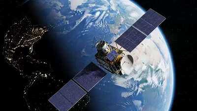
Tech giant Google has made its popular platform, Google Earth, even smarter. The company has incorporated its latest Gemini AI models, which will help understand and respond to floods, droughts, wildfires, and other natural disasters around the world. This new initiative takes Google's Earth AI platform to a new level, where, with the help of geospatial AI, it will assist governments and organizations worldwide in disaster management and environmental monitoring.
Gemini AI will provide real-time data.
According to Google, its Flood Forecasting System now reaches over two billion people worldwide. This helps organizations like World Vision better plan food and clean water distribution in times of need. The company stated that during the California wildfires in 2025, Google Maps and Crisis Alerts helped 15 million people reach safe shelters in time.
Geospatial Reasoning: Data Drives Accurate Analysis
Google's new feature, Geospatial Reasoning, will now combine various data sources, such as weather, population, and satellite imagery, to create a comprehensive analysis. This will help organizations determine which areas will be most affected by a storm or flood, and where relief efforts should begin first. For example, the organization GiveDirectly can now combine flood and population data to determine which areas need assistance most quickly. Google has invited such organizations to become Trusted Testers to gain early access to this technology.
Integrating AI into Google Earth
Google is now integrating its Earth AI tools into Google Earth. This will allow users to quickly analyze satellite images to identify areas where water scarcity is increasing, where wildfires are at risk, or which reservoirs are drying up.
For example, water departments can detect the risk of drying rivers and dust storms.
Environmental agencies can identify algae problems in drinking water sources promptly.
This feature will currently be available to Google Earth Professional and Professional Advanced users in the US. Users with Google AI Pro and Ultra subscriptions will have access to more data.
Earth AI Now on Google Cloud
Google has announced that its Earth AI models will now be available on the Google Cloud platform.
This will enable companies to combine their data with Google's AI models for environmental monitoring, climate change analysis, and disaster response strategies.
Global Results
Google's Earth AI is already in use in several places:
The WHO Africa Office is using it to predict diseases like cholera.
Satellite companies like Planet and Airbus are using it to monitor deforestation and vegetation around power lines.
Alphabet X's unit, Bellwether, is using it to predict storms and speed up insurance claims.
Google's new Earth AI platform is no longer just a mapping tool, but an AI-enabled environmental analysis system.
This will help governments, research institutions, and environmental organizations respond to climate change and natural disasters in real time.
Disclaimer: This content has been sourced and edited from Amar Ujala. While we have made modifications for clarity and presentation, the original content belongs to its respective authors and website. We do not claim ownership of the content.
You may also like

"No one will be spared": Maharashtra CM on Satara woman Doctor's suicide case

Trump is itching for a war with Venezuela. It's oil and more

Epping migrant sex offender urged by police to hand himself in after prison release error

Home Office to make major change to police rules in UK

CA warns about 'India's biggest financial scam': Common money trap could cost lakhs of loss. How to stop wealth drain


